Dynamic Locator and Trail Maps
Building a nice looking Map is fairly easy these days thanks to tools like Google Maps. Google has a handy javascript API that makes it easy to add markers, icons and lines to maps you display. The hard part is actually collecting all the latitude and longitude coordinates. The other hard part is managing all this data over time.
For those that want to build their own maps with Google’s API, hop on over to Google’s guides to get started. If you’re interested in the maps Trail Data Manager enables:
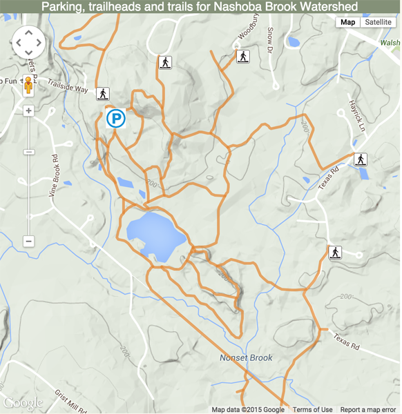
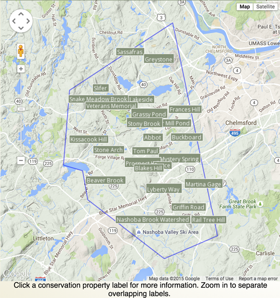
We’ve built locator maps and a more detailed drill-down map that shows parking, trailheads and trails from data stored in Trail Data Manager’s database. The locator map shows all the properties, optionally bounded by the town’s border:
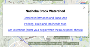
Clicking a property’s marker label opens an info window with choices to see the detailed page in the website, drill down into the parking, trails and trailheads map or get directions from Google Maps.
Clicking the link for the Parking, Trails and Trailheads Map shows a detailed view of the property: