Using Google Earth to show change over time
Have you found yourself working on a grant application or preparing a public presentation trying to figure out how to show what has happened to a space over time? Maybe you want to show the effects of invasive species and what an area might look like if brought back to pre-invasion status.
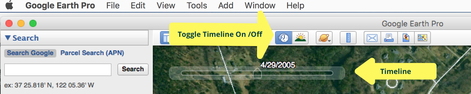
Google Earth’s Historical Imagery feature can help if the area is larger and viewable from above.

I recently worked with a fellow trustee of Littleton Conservation Trust to show the before and after views of 20 years of vegetation and development in an area. He was working on a grant application to try to secure some funds to restore this area to a true natural state, sans invasive species.
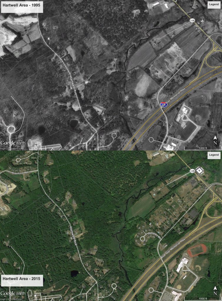
By saving images from Google Earth from 1995 historical imagery and current imagery, we were able to show the “progress” over the years. Time will tell how effective this was in the grant application. One challenge is that Google seems to show roads whether they were there in the past or not. It may lack the data to know when a road appeared. You can handle this by labelling the map or by erasing the roads with Photoshop’s Content-Aware Fill, ON1 Photo’s Perfect Eraser or similar software but it is probably a good idea to footnote the erasing so there’s no confusion is a grant reader looks up their own view and wonders about the difference.